Getting into the science behind the earthquake events in Turkey on Monday seems almost insensitive at this point.
With the window for their rescue rapidly closing, more than 22,000 people have already been confirmed dead, and an undetermined number remain trapped.
Nevertheless, science will continue. Future lives will be saved by the lessons learned from this incident.
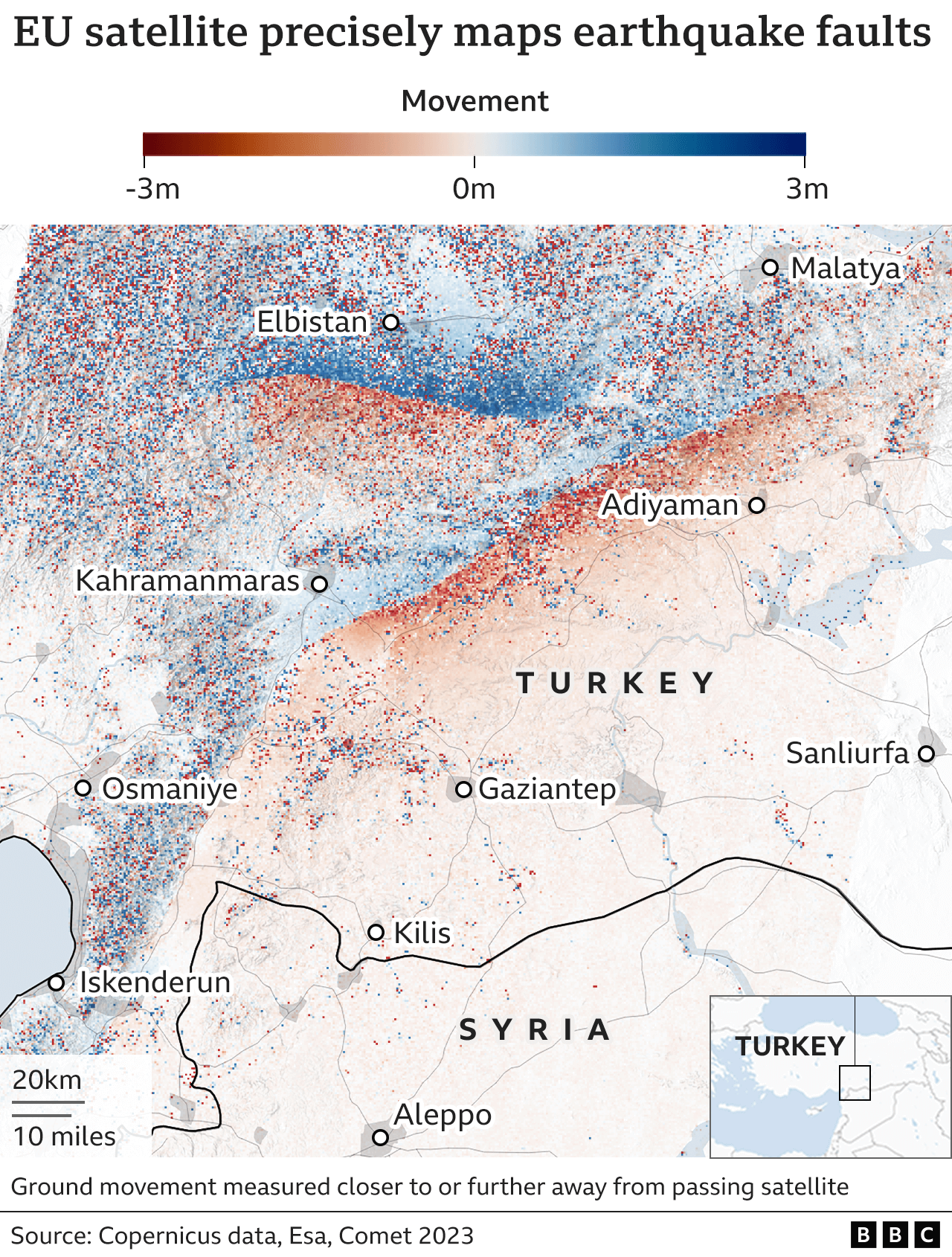
Examine the map on this page. It is the most accurate description yet given of how the ground trembled as a result of the enormous energies that were released.
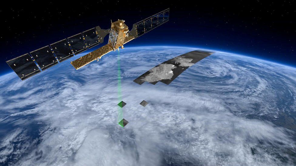
The information contained therein was gathered early on Friday morning by the Sentinel-1A satellite of the European Union as it crossed Turkey from north to south at a height of 700 km (435 miles).
A radar device that can detect the ground in all conditions, day and night, is carried by the Sentinel.
It regularly scans this earthquake-prone area of the world, tracing the frequently minute elevation changes at the Earth's surface.
Of course, the changes made on Monday were anything but subtle; they were extremely significant. The ground twisted, sagged, and at times tore itself apart.
To compare "before" and "after" views, researchers employ the interferometry technique. To see the implications for Turkey in the most recent Sentinel map, however, you don't actually need to be an expert.
Here, red indicates movement toward the satellite since it last flew over the nation, while blue indicates movement away from the satellite.
The East Anatolian Fault line and the area around it have clearly deformed the ground.
The motion is "left-lateral" for both the Magnitude 7.5 event at 10:24 and the Magnitude 7.8 event, which occurred first on Monday at 01:17 GMT. The other side of the fault, whichever side you are on, has shifted to the left, in other words. as well as several meters in some places.
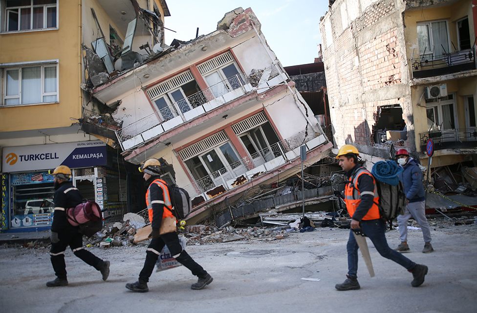
The shocking thing is that the lines of rupture have directly cut through settlements and in many cases, buildings.
Scientists will be able to better comprehend what occurred on Monday thanks to the Sentinel map, which will also help them develop regional earthquake models and, ultimately, risk assessments that the Turkish government will use to plan its recovery efforts.
The relationship between the two significant tremors and what that might mean for future instability will undoubtedly be a topic of much discussion.
UK Center for Observation and Modeling of Earthquakes, Volcanoes, and Tectonics (Comet) processed the map. According to its director, Prof. Tim Wright, the Sentinel observations vividly illustrated the scope of the forces at play.
"News outlets always depict the epicenter of earthquakes as if it were a single point source (like a bomb). According to him, extended fault slip is the real cause of all earthquakes, and the larger the earthquake, the larger the ruptured fault was.
"Those ruptures are mappable by satellite because the ground is displaced around them, in this case by up to 5 or 6 meters. The second major event ruptured a different fault for another 140 km or so, adding to the 300 km or so of the first event's rupture. For comparison, London and Paris are about 345 kilometers apart.
"Damage will be greatest close to the fault, but it also occurs in a large area on either side of the fault, of course. It's dreadful beyond belief.
Geologists used to walk the rupture lines to map earthquake faults prior to the invention of satellites. It was a tedious process that inevitably left out a lot of information. In the last few years, radar interferometry from space has emerged as a particularly compelling tool. It was first developed in the 1990s.
That's due in part to the caliber of the sensors that are currently in orbit, but it's also the outcome of more potent computers and cleverer algorithms.
Today, within hours of a satellite making an overhead pass, a data product can be downloaded to experts' computers and made ready for analysis. Sadly, Comet had to wait a few days for Sentinel-1A to be in the ideal sky position to get the best possible view of Turkey. But as more radar satellites are launched, the situation will get better.
By the end of the decade, we ought to be able to conduct this type of analysis within a day of the most destructive earthquakes, at which point we'd be more helpful to the relief effort. Currently, we are obviously past the 72-hour window for search and rescue, according to Prof. Wright.