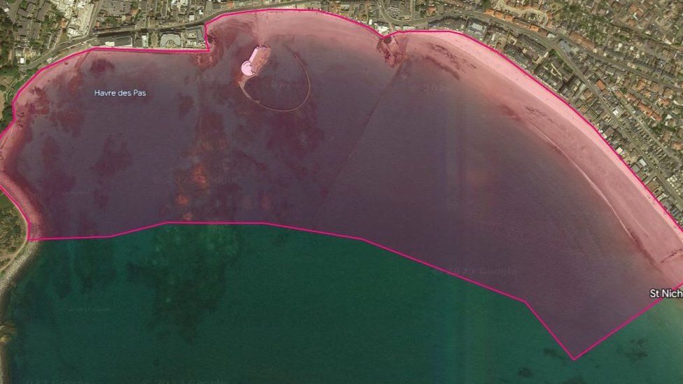
As part of the Shoreline Management Plan, a number of drone topographic surveys will be conducted in Jersey.
The surveys will use the Point Cloud technique, which produces a 3D representation of an area, to map out the coastal defenses at Havre des Pas.
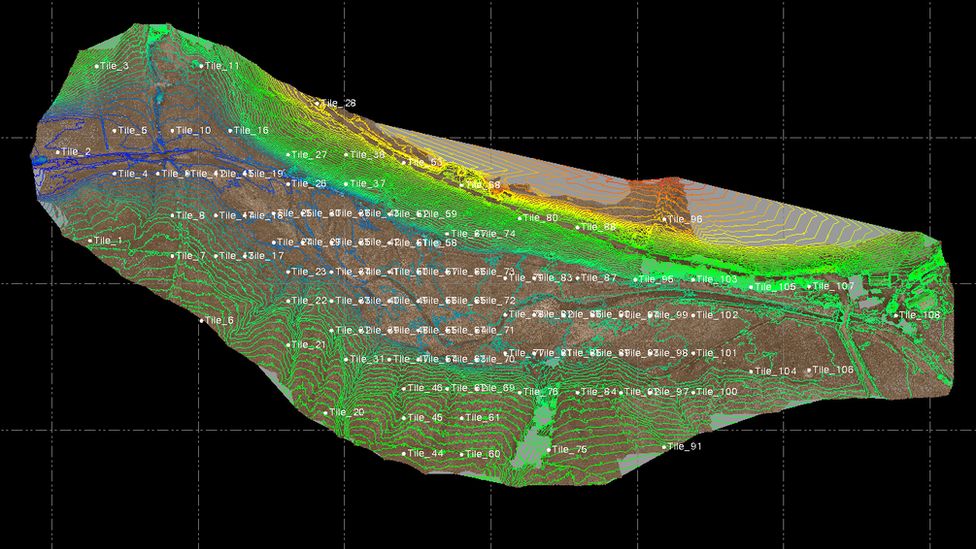
In order to create a 3D image of the defenses and beach profile, millions of scan points will be recorded.
The drones will be operational in the area every day from 5:00 to 11:00 BST from Monday through Friday.
People would not be recorded during the scanning and data processing processes, according to the government, which would only collect information about geographic terrain and structures.
This survey will then be combined with previous evaluations to help determine the best options for upgrading flood protection.